
Cotswold Lakes Guides
With over 180 lakes set in 42 square miles, a map of the Cotswold Lakes can come in very handy.
Cotswold Lakes Maps & Guides
Maps and guides are available from the Visitor Centre, or from many of the accommodation and activity providers based in the Cotswold Lakes.
To download a PDF, click the links below – the Leisure Map, walking and cycle routes are A2 at flat size, so you may need to piece it together!
If you would prefer a paper copy of the maps or guides – you can either buy them at the Visitor Centre or online here.

2026 Leisure Map (PDF) – information and contact details for the main activity and accommodation providers available in the Cotswold Lakes, along with the main walking and cycle routes in the area.
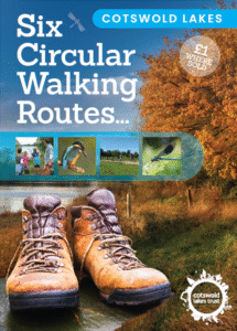
Six Circular Walking Routes (PDF) – a map of the Cotswold Lakes with directions for details of six circular walks and a cycle ride, varying in length from 1km – 18km. For more information and to download the individual walks and routes, go to the Walking page.

Six Circular Cycling Routes (PDF) – a map of the Cotswold Lakes with directions for details of six circular cycling routes, varying in length from 12km – 42km. For more information on cycling in the Cotswold Lakes, have a look at the Cycling page.

Nature Reserve Guide (PDF) – A guide to the locations of Cotswold Lakes Nature Reserves and more detailed information on each one. Also have a look at the Nature Reserves page.
Cotswold Lakes Interactive Map
To discover great places to stay, where to eat & drink and the wide variety of entertainment and adventure available in the Cotswold Lakes – take a look at our online interactive map.
